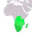
Fayl:LocationSouthernAfrica.png
Qiyofa
LocationSouthernAfrica.png (359 × 359 piksel, fayl hajmi: 8 KB, MIME tipi: image/png)
Fayl tarixi
Faylning biror paytdagi holatini koʻrish uchun tegishli sana/vaqtga bosingiz.
| Sana/Vaqt | Miniatura | Oʻlchamlari | Foydalanuvchi | Izoh | |
|---|---|---|---|---|---|
| joriy | 13:16, 2022-yil 11-noyabr |  | 359 × 359 (8 KB) | ColorfulSmoke | . |
| 11:55, 2022-yil 11-noyabr |  | 360 × 359 (8 KB) | ColorfulSmoke | ||
| 16:54, 2018-yil 17-mart |  | 360 × 392 (11 KB) | Maphobbyist | Upload | |
| 21:22, 2011-yil 9-iyul |  | 360 × 392 (14 KB) | Maphobbyist | South Sudan has become independent on July 9, 2011. Sudan and South Sudan are shown with the new international border between them. | |
| 08:11, 2007-yil 11-dekabr |  | 360 × 392 (14 KB) | Hoshie | added Cabinda (Angola) and Montenegro. | |
| 16:01, 2006-yil 2-aprel |  | 360 × 392 (9 KB) | E Pluribus Anthony~commonswiki | Reverted to earlier revision | |
| 05:45, 2006-yil 1-aprel |  | 360 × 392 (14 KB) | Aris Katsaris | Cleaner -- there's no need to include SADC at all here. | |
| 18:41, 2006-yil 5-fevral |  | 360 × 392 (9 KB) | E Pluribus Anthony~commonswiki | Map: Southern Africa (location) |
Fayllarga ishoratlar
Bu faylga quyidagi sahifa bogʻlangan:
Faylning global foydalanilishi
Ushbu fayl quyidagi vikilarda ishlatilyapti:
- ace.wikipedia.org loyihasida foydalanilishi
- af.wikipedia.org loyihasida foydalanilishi
- als.wikipedia.org loyihasida foydalanilishi
- am.wikipedia.org loyihasida foydalanilishi
- ar.wikipedia.org loyihasida foydalanilishi
- ليبيا
- جيبوتي
- موريتانيا
- تونس
- السودان
- الصحراء الغربية
- أنغولا
- أوغندا
- إسبانيا
- تشاد
- النيجر
- مالي
- السنغال
- غامبيا
- غينيا بيساو
- غينيا
- سيراليون
- ليبيريا
- غانا
- توغو
- بنين
- بوركينا فاسو
- الصومال
- كينيا
- تنزانيا
- الغابون
- زامبيا
- موزمبيق
- زيمبابوي
- البرتغال
- الكاميرون
- جمهورية الكونغو الديمقراطية
- بوتسوانا
- جنوب إفريقيا
- جمهورية إفريقيا الوسطى
- جمهورية الكونغو
- سيشل
- ناميبيا
- مدغشقر
- ليسوتو
- موريشيوس
- نهر النيل
Ushbu faylni koʻproq global foydalanishdan koʻring.

