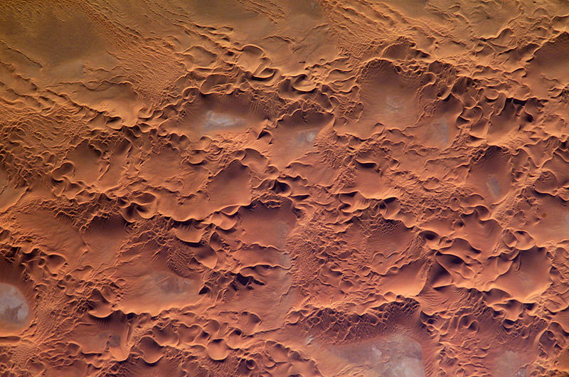
Fayl:IssaouaneErg Algeria ISS010-E-13539.jpg
Qiyofa

Bu prevyuning hajmi: 800 × 530 piksel. Boshqa oʻlchamlari: 320 × 212 piksel | 640 × 424 piksel | 1 000 × 662 piksel.
Asl fayl (1 000 × 662 piksel, fayl hajmi: 491 KB, MIME tipi: image/jpeg)
Fayl tarixi
Faylning biror paytdagi holatini koʻrish uchun tegishli sana/vaqtga bosingiz.
| Sana/Vaqt | Miniatura | Oʻlchamlari | Foydalanuvchi | Izoh | |
|---|---|---|---|---|---|
| joriy | 17:58, 2006-yil 18-may |  | 1 000 × 662 (491 KB) | Holly Cheng | ==Summary== {{Information | Description=Astronaut photo of the Issaouane Erg (Sahara Desert), Algeria. | Source=http://earthobservatory.nasa.gov/Newsroom/NewImages/images.php3?img_id=16813 | Date=January 16, 2005 | Author=ISS Crew Earth Observations exper |
Fayllarga ishoratlar
Bu faylga quyidagi 2 sahifalar bogʻlangan:
Faylning global foydalanilishi
Ushbu fayl quyidagi vikilarda ishlatilyapti:
- ar.wikipedia.org loyihasida foydalanilishi
- ba.wikipedia.org loyihasida foydalanilishi
- be.wikipedia.org loyihasida foydalanilishi
- bg.wikipedia.org loyihasida foydalanilishi
- br.wikipedia.org loyihasida foydalanilishi
- ceb.wikipedia.org loyihasida foydalanilishi
- da.wikipedia.org loyihasida foydalanilishi
- de.wikipedia.org loyihasida foydalanilishi
- en.wikipedia.org loyihasida foydalanilishi
- eo.wikipedia.org loyihasida foydalanilishi
- fi.wikipedia.org loyihasida foydalanilishi
- fr.wikipedia.org loyihasida foydalanilishi
- fr.wiktionary.org loyihasida foydalanilishi
- hi.wikipedia.org loyihasida foydalanilishi
- it.wikipedia.org loyihasida foydalanilishi
- it.wikibooks.org loyihasida foydalanilishi
- ka.wikipedia.org loyihasida foydalanilishi
- lt.wikipedia.org loyihasida foydalanilishi
- mhr.wikipedia.org loyihasida foydalanilishi
- mk.wikipedia.org loyihasida foydalanilishi
- nn.wikipedia.org loyihasida foydalanilishi
- pl.wikipedia.org loyihasida foydalanilishi
- pl.wiktionary.org loyihasida foydalanilishi
- ro.wikipedia.org loyihasida foydalanilishi
- ru.wikipedia.org loyihasida foydalanilishi
- sl.wikipedia.org loyihasida foydalanilishi
- sr.wikipedia.org loyihasida foydalanilishi
- sv.wikipedia.org loyihasida foydalanilishi
- sv.wiktionary.org loyihasida foydalanilishi
- uk.wikipedia.org loyihasida foydalanilishi
- vi.wikipedia.org loyihasida foydalanilishi
- www.wikidata.org loyihasida foydalanilishi
